Boundary Waters Canoe Area Wilderness continues opening up closure areas
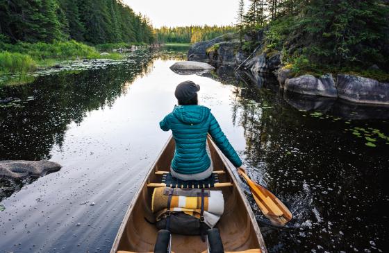
Photo: Jeff Anderson Photo - jeffandersonphoto.co
Great news for BWCAW paddlers and travelers! Additional sections of the Boundary Waters Canoe Area Wilderness (BWCAW) are reopening, along with Superior National Forest recreation sites, as firefighters continue to make progress on the wildfires that began in early July.
The U.S. Forest Service first closed the BWCAW on July 14 following an unprecedented series of lightning-caused fires, including the Bear Trap, Sioux, and Thumb Fires. Since then, recreation opportunities have been returning in phases as conditions allow. While many entry points and trails are now open, some areas remain closed due to ongoing wildfire activity, fire suppression operations, hazardous conditions, and the need to repair damaged trails and portages before they can safely reopen. Permit reservations for closed entry points remain unavailable through August 10, 2026.
Know before you go.
If you're planning a trip into a recently reopened area, the U.S. Forest Service encourages all visitors to be prepared for changing conditions. Travel may still be affected by nearby wildfire activity, and services in the backcountry may be limited.
Visitors should:
- Have a detailed trip plan and share it with someone at home.
- Check the latest weather forecast and wildfire conditions before entering.
- Carry multiple methods of communication, such as a satellite messenger or emergency beacon.
- Be prepared to be completely self-sufficient in a remote wilderness setting.
For the latest closure information, maps, and reopening announcements, visit the U.S. Forest Service BWCAW Wildfire Area Closures webpage:
https://www.fs.usda.gov/r09/superior/alerts/bwcaw-wildfire-area-closures
Updated August 3, 2026
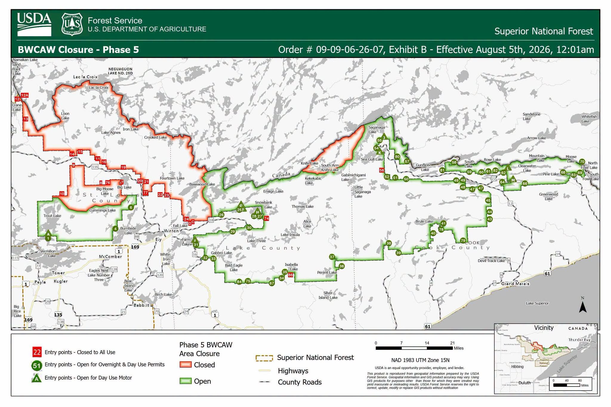
OPEN ENTRY POINTS
Gunflint Ranger District
Open to overnight use (August 4):
- EP 43 – Bower Trout Lake
- EP 44 – Ram Lake
- EP 45 – Morgan Lake
- EP 47 – Lizz and Swamp Lakes
- EP 48 – Meeds Lake
- EP 49 – Skipper and Portage Lakes
- EP 50 – Cross River
- EP 51 – Missing Link Lake
- EP 52 – Brant Lake
- EP 54 – Seagull Lake
- EP 55 – Saganaga Lake
- EP 57 – Magnetic Lake
- EP 58 – South Lake
- EP 59 – Partridge/South Lake Trail
- EP 60 – Duncan Lake
- EP 61 – Daniels Lake
- EP 62 – Clearwater Lake
- EP 64 – East Bearskin Lake
- EP 66 – Crocodile River
- EP 68 – Pine Lake
- EP 69 – John Lake
- EP 70 – North Fowl Lake
- EP 78 – Brule Lake Trail
- EP 79 – Eagle Mountain Trail
- EP 80 – Larch Creek
- EP 81 – Border Route Trail (West)
- EP 82 – Border Route Trail (Center)
- EP 83 – Border Route Trail (East)
Open for Day Use Motor:
- EP J – Saganaga Lake
- EP K – Seagull Lake
- EP L – Clearwater Lake
- EP M – East Bearskin Lake
Tofte Ranger District
Open to overnight use (July 30):
- EP 34 – Island River
- EP 35 – Isabella Lake
- EP 36 – Hog Creek
- EP 37 – Kawishiwi Lake
- EP 38 – Sawbill Lake
- EP 39 – Baker Lake
- EP 40 – Homer Lake
- EP 41 – Brule Lake
- EP 67 – Bog Lake
- EP 75 – Little Isabella River
- EP 84 – Snake River
Kawishiwi Ranger District
Open to overnight use (August 5):
- EP 6 – Slim Lake
- EP 25 – Moose Lake (No paddle travel beyond Lewis Narrows and Upper Basswood Falls.)
- EP 26 – Wood Lake
- EP 27 – Snowbank Lake
- EP 28 – Snowbank Lake Only
- EP 29 – North Kawishiwi River
- EP 30 – Lake One
- EP 31 – Farm Lake
- EP 32 – South Kawishiwi River
Open to overnight use (July 30):
- EP 33 – Little Gabbro Lake
LaCroix Ranger District
Open to overnight use (August 5):
- EP 1 – Trout Lake
- EP 4 – Crab Lake & Cummings Lake
Open for Day Use Motor (July 30):
- EP A – Trout Lake
CLOSED ENTRY POINTS
The following BWCAW entry points remain closed because they are not included in the Forest Service reopening orders:
Entry points 11-Blandin Trail, 14-Little Indian Sioux River North, 15-Sioux-Hustler Trail, and 19-Stuart River, are canceled through the end of the quota permit season on September 30. These areas were directly impacted by the wildfires and need maintenance and rehabilitation to ensure they are accessible to visitors.
Kawishiwi Ranger District
- EP 2 – Angleworm Lake
- EP 23 – Mudro Lake
- EP 22 – Mudro Lake (Restricted)
- EP 24 – Fall Lake
- EP 7 – From Big Lake
- EP 65 – From Canada
- EP 71 – South Hegman Lake
- EP 19 – Stuart River
LaCroix Ranger District
- EP 12 – Little Vermilion Lake
- EP 13 – Lac La Croix Only
- EP 14 – Little Indian Sioux North
- EP 9 – Little Indian Sioux South
- EP 16 – Moose River South
- EP 15 – Moose/Portage River North
Closed BWCAW Overnight Hiking Trails
Kawishiwi Ranger District
- Angleworm Lake Trail (OH)
- Kekekabic Trail (West) / Snowbank (OH)
- North Country Trail – West (Thru-Hike) (OH)
Gunflint Ranger District
- Kekekabic Trail (East) (OH)
- North Country Trail – East (Thru-Hike) (OH)
Tofte Ranger District
- Pow Wow Trail (OH)
LaCroix Ranger District
- Big Moose Lake Trail (OH)
- Blandin Trail (OH)
- Herriman Lake Trail (OH)
- Norway Trail (OH)
- Sioux-Hustler Trail (OH)
Open BWCAW Overnight Hiking Trails
These trails are included in the Forest Service reopening order and are open for overnight use:
- Border Route Trail (West)
- Border Route Trail (Center)
- Border Route Trail (East)
- Brule Lake Trail
- Eagle Mountain Trail
- Partridge Lake Trail
USFS Campgrounds:
- Trails End Campground - Open
- Fall Lake - set to reopen August 7, 2026.
- Fenske Lake Campground - set to reopen August 7, 2026.